Welcome To Kongu Nadu Kongu Tamil Site
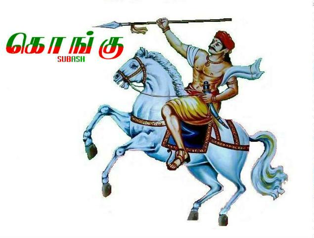
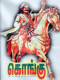


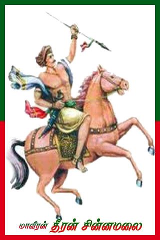
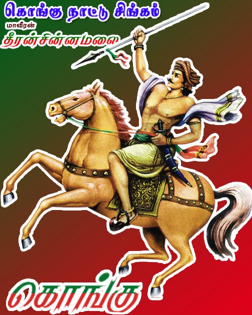


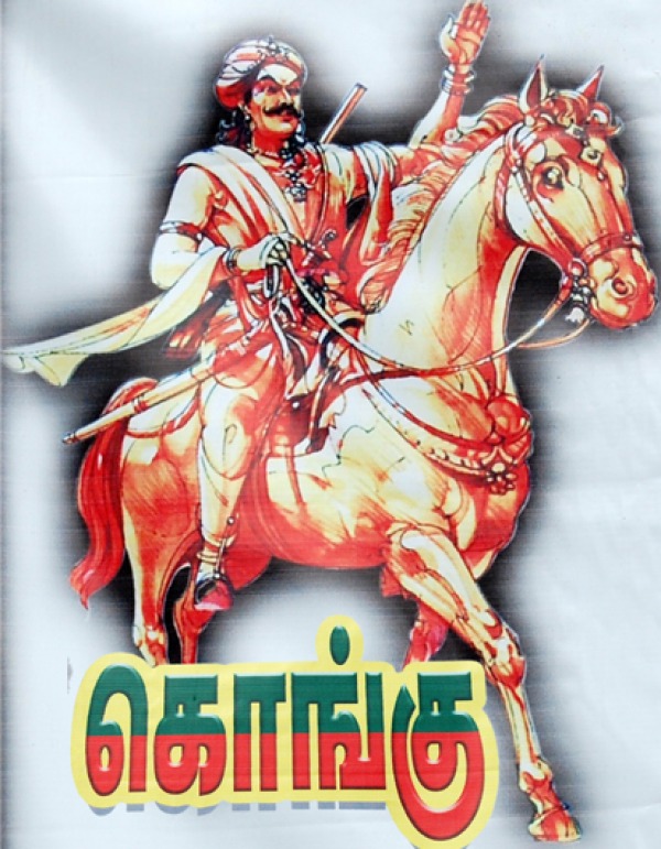
கொங்கு நாடு
விநாயகர் காப்பு
Welcome Kongu people and others to this exclusive blog on Kongunadu
Ancient name : Gangavadi
Ancient capital : Gangeyam (Kangeyam)
Ancient language : Gangeya Bhasai(Kangee or Gangee)
Ancient dynasty : Gangas(Kongas)
What is Kongu?Kongunadu is at present the region the north western frontier of the southernmost Indian state Tamil Nadu. This region is otherwise called the 'Coimbatore zone' or the 'West zone'. Let us see the historical frontiers of the region.
Valasundara Kavirayar, probably a seventeenth century poet, hailing from Vijayamangalam (near Perundurai) versifies the borders of the Kongu mandalam during the Vijayanagara empire in his book Kongumandala satakam (1) :
வடக்கு நந்திகிரி வராககிரி தெற்கு
குடக்கு பொறுப்பு வெள்ளிக்குன்று
களித்தன்டலை மேவு காவிரிசூழ்
நாடு-குளித்தன்டலை அளவு கொங்கு.
Thus the borders of Kongu of the seventeenth century are :Northern : Nandigiri (Nandi hills in Kolar and Tumkur dists. of Karnataka located seventy kilometeres to the north of today's Bengaluru).
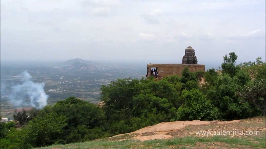
Southern : Varahagiri (Panrimalai mountain in the Palani-Kodaikkanal ranges, Panrimalai is referred in it's Sanskrit name).
Eastern : Kudagu and Vellikundru (Kodagu in the Madikeri dist. of Karnataka and Vellingiri hills near Coimbatore which form the border with Kerala).
Western : Kulithalai (Karur dist. located on the Karur- Tiruchirappalli highway).Further he adds that the region is like a basin (Kavirisoozh) and surprises us with his geographical knowledge through expressing Kongu as the entire Kaveri catchment basin, the Kaveri valley. I have drawn an approximate map, from google earth of the desccribed region. This region comprises of the following modern districts of the following states.
Tamilnadu : Coimbatore, Erode, Udagamandalam, Krishnagiri, Dharmapuri, Salem, Namakkal, Karur, Dindigul (excluding the Nattam, Nilakkottai and southward slopes of Kodaikkanal taluk), Vellore (Tiruppattur taluk only), Villuppuram (Kalrayan hills only), Perambalur (Pachamalai hills only) and Tiruchirappalli (Pachamalai hills, Turaiyur taluk's western parts and Musiri panchayat union).
Karnataka : Madikeri, Chickmagalur, Hassan, Tumkur, Kolar, Bangalaore Urban, Bangalore Rural, Mandya, Mysore and Chamrajnagar.
Kerala : Wayanad, Palakkad (villages with a majority Tamil speaking population now only), Malappuram (Bhavani river valley only) and Idukki (Amaravati river valley only).
One thing which got clear beyond doubt after my research which is also commonplace knowledge is that the Kongu region, from the dawn of history is always connected to the southern part of the Karnataka state which is given, which is also called in Karnataka as Mysore Karnataka or Hoysala Karnataka. The Kongu region has always been along with this region from the dawn of history to the collapse of the Mysore Kingdom and the arrivel of the British.
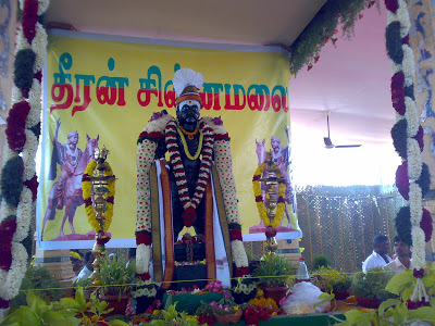
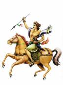
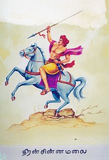
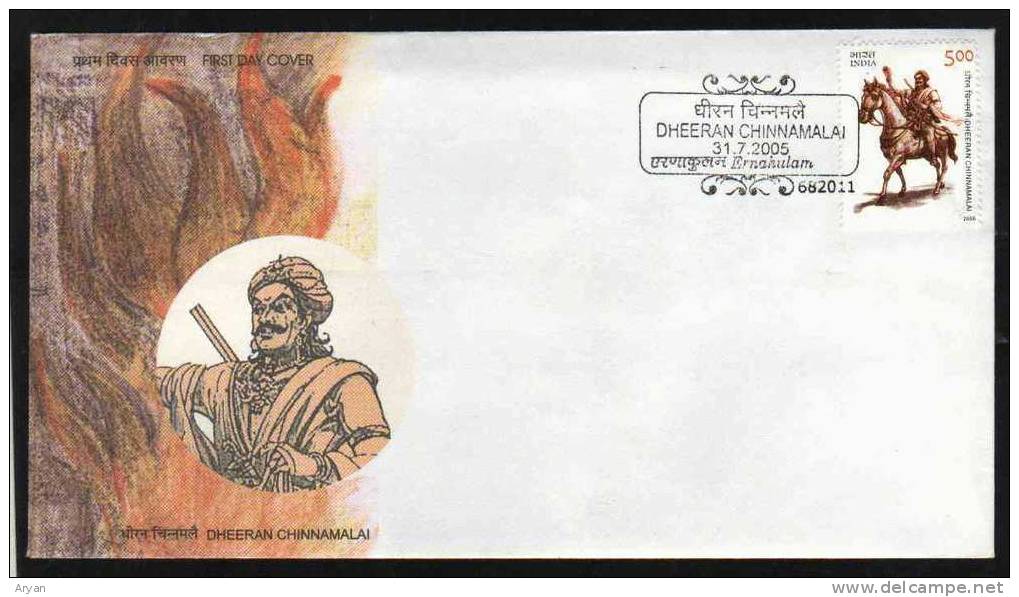
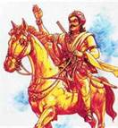
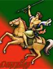
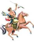
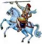
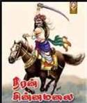
Thus I also broadened my postmodernist research and found many revelations. The first was that the original name of Kongunadu as mentioned in the Komaralingam copperplates (2)inscriptions give the name of the region as Kanku (கங்கு). When we go in detailed research, the name of the Gangas appear. These local cheiftains are mentioned in the Sangam Akananooru (verse 44 ) as Gangan (கங்கன்). These must have probably the feudatories of the Cheras at the beginning. Suddenly as a gust of luck or predestined intervention, I noticed the name of my mother's cousin Suriyakangeya Sukumar (a famous ophamologist in Erode). He is named after his Grandfather Suriyakangeya Gounder. Then I got information that there is another branch of my mother's clan Kalamangalam Kannan koottam who got the pattam of Morur Kangeyar. I could also find that these branches had been fanned out from the village of Kannivadi (Kangivadi?) due to their friction with Vanniar (Kalabhras) who came as an influx into Kongunadu. (to be cond.)
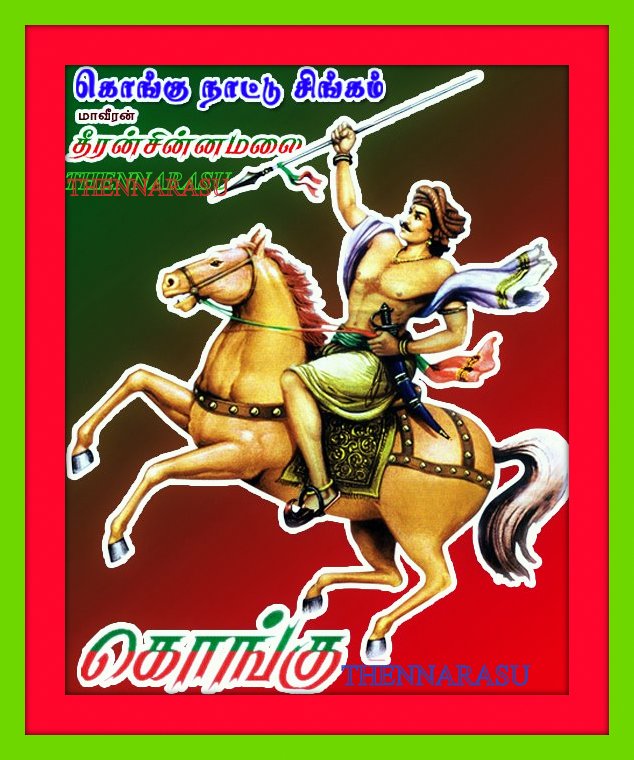
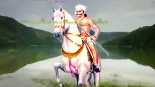
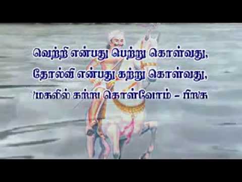
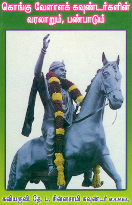
Kongu Nadu,the nomenclature: There has been a lot of controversy regarding the name of Kongu.It is a fact thet Kangars(the Tamil version of Gangas)according to Kongu Desa Rajakkal from the lapse of Mahabharata and the starting of Kaliyugam(3106B.C) ruled Kongu Nadu for some period.Some people had concluded that the region ruled by Gangars was initially called `Ganga Nadu` and with the passage of time,it began to be called `Kongu Nadu`,as mentioned by Thirumathi T.K. Sathi Devi, in her book `Kongu Vellalar Varalaaru`. There has been mass hype over the name Kongu where Dravidian Tamil bygots say it to be Kongu honey,Kongu flower and even Kongu meaning mentally deranged! According to inscriptions,it is mentioned as கங்க,which is read by Tamil bygots,as the people who reside in the edge கங்கு.This means that the region is on the edge but if you see any map Kongu always has been strategically located.The importance of Kongu has given Tamilsayings :
கொங்கு செழித்தால் எங்கும் செழிக்கும்.
கொங்கில் வாழான் எங்கும் வாழான்.It has always been the centre of wealth because ancient Kongu had the only gold mines of all south asia, Gold fields which in the Kongu Mandala Shatakam which are said to have given all the gold to the roof of the Chidambaram Natarajar temple. Kongu Nadu still contributes 2/3 revenue of the state of Tamilnadu.
The borders of Kongu Nadu : The borders of Kongu Nadu(Ganganadu) according to the Jain period poet of Vijayamangalam
விநாயகர் காப்பு
- ஐந்து கரத்தனை யானை முகத்தனை
இந்தின் இளம்பிறை போலும் எயிற்றனை
நந்தி மகன்தனை ஞானக் கொழுந்தினைப்
புந்தியில் வைத்தடி போற்றுகின் றேனே.
Welcome Kongu people and others to this exclusive blog on Kongunadu
Ancient name : Gangavadi
Ancient capital : Gangeyam (Kangeyam)
Ancient language : Gangeya Bhasai(Kangee or Gangee)
Ancient dynasty : Gangas(Kongas)
What is Kongu?Kongunadu is at present the region the north western frontier of the southernmost Indian state Tamil Nadu. This region is otherwise called the 'Coimbatore zone' or the 'West zone'. Let us see the historical frontiers of the region.
Valasundara Kavirayar, probably a seventeenth century poet, hailing from Vijayamangalam (near Perundurai) versifies the borders of the Kongu mandalam during the Vijayanagara empire in his book Kongumandala satakam (1) :
வடக்கு நந்திகிரி வராககிரி தெற்கு
குடக்கு பொறுப்பு வெள்ளிக்குன்று
களித்தன்டலை மேவு காவிரிசூழ்
நாடு-குளித்தன்டலை அளவு கொங்கு.
Thus the borders of Kongu of the seventeenth century are :Northern : Nandigiri (Nandi hills in Kolar and Tumkur dists. of Karnataka located seventy kilometeres to the north of today's Bengaluru).
Southern : Varahagiri (Panrimalai mountain in the Palani-Kodaikkanal ranges, Panrimalai is referred in it's Sanskrit name).
Eastern : Kudagu and Vellikundru (Kodagu in the Madikeri dist. of Karnataka and Vellingiri hills near Coimbatore which form the border with Kerala).
Western : Kulithalai (Karur dist. located on the Karur- Tiruchirappalli highway).Further he adds that the region is like a basin (Kavirisoozh) and surprises us with his geographical knowledge through expressing Kongu as the entire Kaveri catchment basin, the Kaveri valley. I have drawn an approximate map, from google earth of the desccribed region. This region comprises of the following modern districts of the following states.
Tamilnadu : Coimbatore, Erode, Udagamandalam, Krishnagiri, Dharmapuri, Salem, Namakkal, Karur, Dindigul (excluding the Nattam, Nilakkottai and southward slopes of Kodaikkanal taluk), Vellore (Tiruppattur taluk only), Villuppuram (Kalrayan hills only), Perambalur (Pachamalai hills only) and Tiruchirappalli (Pachamalai hills, Turaiyur taluk's western parts and Musiri panchayat union).
Karnataka : Madikeri, Chickmagalur, Hassan, Tumkur, Kolar, Bangalaore Urban, Bangalore Rural, Mandya, Mysore and Chamrajnagar.
Kerala : Wayanad, Palakkad (villages with a majority Tamil speaking population now only), Malappuram (Bhavani river valley only) and Idukki (Amaravati river valley only).
One thing which got clear beyond doubt after my research which is also commonplace knowledge is that the Kongu region, from the dawn of history is always connected to the southern part of the Karnataka state which is given, which is also called in Karnataka as Mysore Karnataka or Hoysala Karnataka. The Kongu region has always been along with this region from the dawn of history to the collapse of the Mysore Kingdom and the arrivel of the British.
Thus I also broadened my postmodernist research and found many revelations. The first was that the original name of Kongunadu as mentioned in the Komaralingam copperplates (2)inscriptions give the name of the region as Kanku (கங்கு). When we go in detailed research, the name of the Gangas appear. These local cheiftains are mentioned in the Sangam Akananooru (verse 44 ) as Gangan (கங்கன்). These must have probably the feudatories of the Cheras at the beginning. Suddenly as a gust of luck or predestined intervention, I noticed the name of my mother's cousin Suriyakangeya Sukumar (a famous ophamologist in Erode). He is named after his Grandfather Suriyakangeya Gounder. Then I got information that there is another branch of my mother's clan Kalamangalam Kannan koottam who got the pattam of Morur Kangeyar. I could also find that these branches had been fanned out from the village of Kannivadi (Kangivadi?) due to their friction with Vanniar (Kalabhras) who came as an influx into Kongunadu. (to be cond.)
Kongu Nadu,the nomenclature: There has been a lot of controversy regarding the name of Kongu.It is a fact thet Kangars(the Tamil version of Gangas)according to Kongu Desa Rajakkal from the lapse of Mahabharata and the starting of Kaliyugam(3106B.C) ruled Kongu Nadu for some period.Some people had concluded that the region ruled by Gangars was initially called `Ganga Nadu` and with the passage of time,it began to be called `Kongu Nadu`,as mentioned by Thirumathi T.K. Sathi Devi, in her book `Kongu Vellalar Varalaaru`. There has been mass hype over the name Kongu where Dravidian Tamil bygots say it to be Kongu honey,Kongu flower and even Kongu meaning mentally deranged! According to inscriptions,it is mentioned as கங்க,which is read by Tamil bygots,as the people who reside in the edge கங்கு.This means that the region is on the edge but if you see any map Kongu always has been strategically located.The importance of Kongu has given Tamilsayings :
கொங்கு செழித்தால் எங்கும் செழிக்கும்.
கொங்கில் வாழான் எங்கும் வாழான்.It has always been the centre of wealth because ancient Kongu had the only gold mines of all south asia, Gold fields which in the Kongu Mandala Shatakam which are said to have given all the gold to the roof of the Chidambaram Natarajar temple. Kongu Nadu still contributes 2/3 revenue of the state of Tamilnadu.
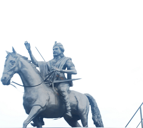
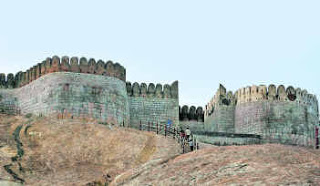
The borders of Kongu Nadu : The borders of Kongu Nadu(Ganganadu) according to the Jain period poet of Vijayamangalam
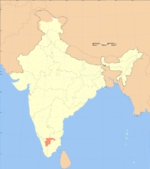
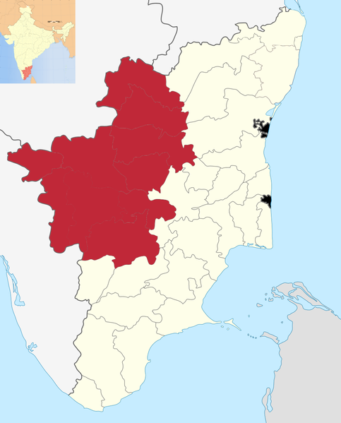
Kongu Nadu
Kongu Nadu
கொங்குநாடு
Geographical area
கொங்குநாடு
Geographical area
Kongu Nadu region within Tamil Nadu
Coordinates: 11°0′45″N 78°9′36″E
Country India
RegionSouth India
Government
• BodyGovernment of Tamil Nadu
Area
• Total25,864 km2 (9,986 sq mi)
Population (2011)[1]
• Total17.6 million
• Density607/km2 (1,570/sq mi)
Time zoneIST (UTC+5:30)
PIN635-642xxx
Vehicle registrationTN 27-42, TN 47, TN 52, TN 54, TN 56, TN 66, TN 77-78, TN 88, TN 99
Largest cityCoimbatore
Literacy62.61%
Civic agencyGovernment of Tamil Nadu
Languages
• OfficialTamil
|
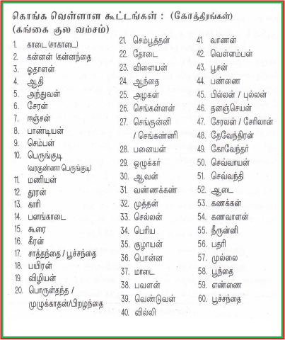
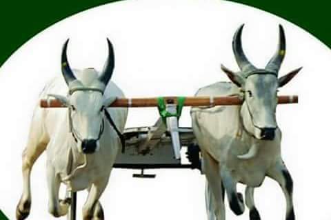
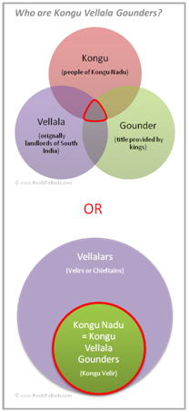
Kongu Vellalar Gounders are predominantly an agricultural community residing in Kongu Nadu, a region in the western part of Tamil Nadu. The community is also engaged in trade and business activities mainly in Kongu Nadu, though many have expanded or moved far beyond the boundaries of Kongu Nadu. Kongu Vellalar Gounders hold prominent positions, globally, in different spheres of life.
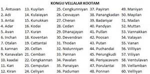
Kongu Vellalar Gounders are often referred to as Kongu Vellala Gounders or Vellala Gounders or simply Gounders. Kongu Vellala Gounders follow Saiva Siddantha traditions of Hinduism. However, not every Kongu Vellala Gounder today restrict themself to the Saiva Siddantha traditions. The Kongu Vellala Gounder community is divided into more than 200 kulams or kootams. Various literature refer to a different number of kulams or kootams. Each kulam has its own Kula Deivam and Kula Guru. The tradition of Kula Deivam is widely practiced. Today, Gounders are actively engaged in the political landscape of Tamil Nadu, with many Gounders holding ministerial positions. Gounders are also represented by a number of regional and international associations as well as political parties. Kongu Vellalar Gounder Community website is attempting to bring together in one place the Gounder community’s history; demographics; social structure; and traditions, customs and rituals. It also strives to identify, honor and immortalize prominent Gounders who have contributed not only to the development and welfare of the community, but also to the country and humanity. Origin of the name Kongu Vellala GounderThere are many different interpretations for the origin of Kongu Vellalar Gounder. Vellalars (aka vellala, velala, velalar) refers to an elite class of agriculturist landlords in Tamil Nadu, Kerala and Sri Lanka. It is widely believed that Vellalars originated from Velirs (i.e., local chieftains or Kurunila Mannargal). Further details on Velirs are in the ancient history section (under development). Vellalars are divided into a number of sub-castes including Gounders, Mudaliars and Pillai. Understanding the meaning and origin of Kongu Vellalar Gounders Kongu refers to people who were originally from the Kongu Nadu region. The common view is that people of Kongu Nadu are Kongu Vellala Gounders (Mudaliars are Thondai Nadu, Pillais are Chola Nadu, etc). There are divergent views on the origin of the word Kongu. It is believed to have come from Kongadesam, where Konga is a variation of Ganga or the land of Gangas. Reference to the word Gangakulam in Kongu Mangala Vazthu is believed to represent Kongu Vellala Gounders. Gangakulam is interpreted to means descendants of King Gangadatta (in Sanskrit “the one”, given by the Goddess Ganga). Kongu also means nectar of flowers. Gounder is widely believed to mean Kongu Vellala Gounders. However, some argue that Gounder is a title (like Mudaliar and Pillai) rather than name of a community or caste. For this reason Gounder is used or claimed by many communities including Vettuvars, Vanniars, etc. The common view is that the word Gounder originated from Kaamindan (noble protector of land and its people). Kaamindan later transformed into Kavundan or Goundan or Gounder. Notwithstanding the lack of clarity, today, Kongu Vellala Gounders are a large, flourishing community with a well developed social structure and established traditions and customs. They are distinct to other Vellalars as well as to other communities using the title or claiming the surname Gounder. Historical research is constrained by lack of documented or reliable information. There are also differing interpretations, claims and counter-claims. RootsToBuds aims to not only continue and support the historical research, but also to try and understand the history based on information available today. Collating information for each Kulam (Kootam), its lineage, its migration history, etc in RootsToBuds Family Tree, will enable creation of a comprehensive record of Kongu Vellala Gounder community, which would help understand the history as well. This would also be the first for any community in the world! |
